Hail Reports in Evansville, Indiana — Last 90 Days
NOAA Storm Prediction Center logged 1 hail report within 25 miles of Evansville across 1 storm day, most recently on August 12, 2026. Source: SPC Local Storm Reports (preliminary, may be revised).
Data as of October 24, 2026 (last successful NOAA check). The newest report in the feed is from Oct 23, 2026. The 90-day log is SPC preliminary data. The county history (2017 to June 2026) is the NOAA Storm Events archive, 2014–June 2026; it has no storms after it ends.
- 1.00 inlargest hail near the city, last 90 days (quarter size)
- 10days with hail 1 in or larger in the county, 2014–June 2026
- 48days with 58+ mph thunderstorm wind, 2014–June 2026
- #158 of 209among the cities we cover, by hail days of 1 in or more
Has hail hit my Evansville roof since it was installed?
County-level hail reports for Evansville from the NOAA archive this page uses; a county report is not proof of damage at your Evansville address.
When does hail hit Evansville?
NOAA NCEI Storm Events, county level, 2014–June 2026
If insurance covers it, what do I pay in Evansville?
Only if the claim is approved. The ACV math is a straight-line example over a 25-year life; insurers writing Evansville policies use their own schedules, so check your policy.
Request Sent!
A local contractor will reach out as soon as they review your request.
Hail near Evansville in the last 90 days
- 1.00 inLargest hail in 90 days (quarter size)
- 1Hail day near Evansville
- 1SPC report
- August 12, 2026Most recent event
Around Evansville, the NOAA Storm Prediction Center logged 1 hail report within 25 miles between August 12 and August 12, 2026, spread over 1 storm day. That day brought stones of 1″ or more, and 1 of the 1 Evansville reports with coordinates fell within 10 miles of the city center. In a typical year Evansville sees about 4 hail-producing storms.
Evansville's storm-climate context
Evansville averages 45.3 inches of annual precipitation and 11.8 inches of seasonal snowfall, with winter totals ranging from as little as 0.5 inches in 2011-12 to 37.9 inches in 1969-70 -- a freeze-thaw variability that stresses roof decks and membrane seals year after year. The recorded high is 111 F on July 28, 1930, and the recorded low is -23 F on February 2, 1951. The city's 201-day average freeze-free period means roughly five months of freeze risk each year, creating repeated expansion-contraction cycles in flashing and underlayment. The Ohio River Flood of 1937 inundated 500 city blocks and remains a reminder of extreme weather exposure in this Ohio River valley location.
Evansville recorded 117,298 residents at the 2020 census, making it the third-largest city in Indiana. The local economy anchors around corporate headquarters including Atlas Van Lines, Shoe Carnival, and OneMain Financial, alongside manufacturing and healthcare. Bristol-Myers Squibb and AT&T operate significant regional facilities. A large chemical and industrial manufacturing base drives steady demand for commercial and industrial roofing alongside the city's substantial residential housing stock.
How close the hail came
Of the 1 Evansville reports, the closest landed 6.2 miles from the city center on August 12, 2026 (1.00″ at 3 NNW Melody Hill). August 12, 2026 was the heaviest day around Evansville, with 1 report and a top stone of 1.00″. Near Evansville, 1 of 1 hail day reached 1″ or larger.
| Distance from city center | Reports | Largest |
|---|---|---|
| Within 5 miles | 0 | — |
| Within 10 miles | 1 | 1.00″ |
| Within 25 miles | 1 | 1.00″ |
Distances are straight-line from the city center to each SPC report point; reports without coordinates are left out of the table.
Hail events near Evansville by date
August 12, 2026 1 report, hail up to 1.00″ (quarter size)
| Time (UTC) | Hail size | Location | Distance from Evansville |
|---|---|---|---|
| 2137 | 1.00″ | 3 NNW Melody Hill, Vanderburgh County | 6.2 mi |
The Evansville tables above list preliminary Local Storm Reports from the NOAA Storm Prediction Center. Sizes are reported hailstone diameters; times are UTC. Reports can be added or corrected for about a day after each event. A quiet log does not mean no hail: small or unreported events happen. The closest report in this window landed 6.2 miles from Evansville's center.
View the 1 Evansville-area report on a map
On the Evansville map, circle positions are the NOAA SPC report coordinates; tap a circle for the date and hail size.
Hail size: < 1″ 1–1.75″ ≥ 2″ not recorded
How severe was it? The NWS yardstick, applied to Evansville's reports
The National Weather Service calls hail severe at 1″ (quarter size) and significant at 2″ (hen-egg size). Scoring Evansville's 1 area report (filed in Vanderburgh County) against that scale: 1 of the Evansville reports met the severe 1″+ criterion — the size at which asphalt shingles start taking granule loss and bruising that shows up as leaks a season later. At these sizes, damage on a Evansville roof is rarely visible from the ground, and homeowners policies typically cover it when it is documented promptly.
Hail history in Evansville: the long picture
County-level NOAA records for the county behind Evansville, 2014–June 2026. Each figure shows its source. Storms after the archive ends are not in these numbers. Ranks count from 1, the highest.
Evansville against the 209 cities we cover
- #158of 209Days with hail 1 in or larger in Evansville: bottom quarter
- #152of 209Days with hail 1.75 in or larger (golf ball) in Evansville: middle
- #110of 209Days with 58+ mph thunderstorm wind in Evansville: middle
- #69of 209Tornadoes in Evansville: middle
- #37of 209Reported storm property damage in Evansville: top quarter
- #29of 209Share of homes built before 1980 in Evansville: top quarter
Hail events by year
| 2017 | 2 |
|---|---|
| 2018 | 3 |
| 2019 | 2 |
| 2020 | 1 |
| 2021 | 1 |
| 2022 | 2 |
| 2023 | 1 |
| 2024 | 2 |
| 2025 | 1 |
Evansville's county peaked at 3 events in 2018, its busiest full year, out of 15 for 2017 to 2025. In 2017–2025, a 0 means the archive holds no event for that year.
Source: NOAA Storm Events Database, county level, 2017–2025Hail history at a glance
- 15Hail events in the county, since 2017 (NOAA)
- 2.00 inLargest hailstone on record
- Mar 30, 2025Last recorded event in the archive
For Evansville's county, NOAA records a most severe stone of 2.00″ and 15 hail events since 2017, close to 2 every year. Set against that baseline, the 1 hail day near Evansville in the 90-day window above runs above the long-term average rate. Check your own Evansville address on the hail risk lookup.
Evansville's county logged fewer hail events than the Indiana median (22 per county since 2017), below the state's typical pace.
Three ways a storm reaches a roof
Hail
Evansville's county days with at least one report at that size. Largest stone: 2.00 in.
Source: NOAA Storm Events Database, 2014–June 2026Thunderstorm wind
48 Evansville's county days with 58+ mph
58 mph is the NWS severe threshold. Strongest gust on record in Evansville's county: 120 mph on May 9, 2014.
Source: NOAA Storm Events Database, 2014–June 2026Tornadoes
11 in Evansville's county
Strongest tornado in Evansville's county: EF2 on the Enhanced Fujita scale.
Source: NOAA Storm Events Database, 2014–June 2026Peak storm month
April
In Evansville's county, 25 of 101 hail, wind and tornado reports (25%) fell in April.
Source: NOAA Storm Events, 2014–June 2026Older homes
74% of Evansville homes built before 1980
About 44,000 of Evansville's 58,785 housing units (share times units, rounded). Median year built: 1960. Housing units, not roofs: many Evansville homes have been re-roofed since.
Source: Census ACS (Evansville city), 2019–2023Year-by-year table with the largest stone
| Year | Recorded hail events | Largest stone |
|---|---|---|
| 2025 | 1 | 1.00″ |
| 2024 | 2 | 1.00″ |
| 2023 | 1 | 0.75″ |
| 2022 | 2 | 1.50″ |
| 2021 | 1 | 1.00″ |
| 2020 | 1 | 1.00″ |
| 2019 | 2 | 1.00″ |
| 2018 busiest largest stone | 3 | 2.00″ |
| 2017 | 2 | 2.00″ |
NOAA Storm Events archive, Evansville's county. Years missing from the table have no record in the archive. * 2026 covers only January to June: NOAA's file ends there, so it is not counted as the worst year or in the yearly average.
2018 was the standout hail year in Evansville's county on both counts: the most recorded events (3) and the largest stone (2.00″).
In a market with repeat hail, impact-resistant Class 4 shingles often pay for themselves through insurer premium discounts — worth discussing with a Evansville roofer if a recent event tips you into a replacement.

Vanderburgh County fact sheet for Evansville homeowners
Housing age, federal disaster declarations and your state's claim deadlines in one place. All three come from public records, county level.
How old are the roofs? Homes in Vanderburgh County by decade built
| pre-1940 | 17.2% |
|---|---|
| 1940s | 8.8% |
| 1950s | 15.4% |
| 1960s | 8.8% |
| 1970s | 13.6% |
| 1980s | 10.4% |
| 1990s | 9.3% |
| 2000s | 10.0% |
| 2010s | 5.7% |
| 2020+ | 0.7% |
84,809 homes, median built in 1970. 63.8% date from before 1980 and 6.4% from 2010 on; 64.5% are owner-occupied. The most common decade is the pre-1940.
Source: U.S. Census Bureau, American Community Survey · data as of ACS 5-yearWhat to do if your roof was in the hail path
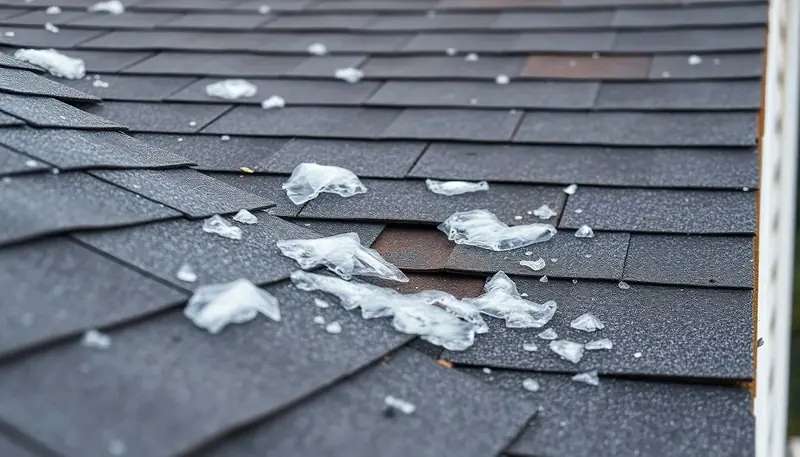
- Stay off the roof and read the yard instead. 6.2 miles from the Evansville city center (3 NNW Melody Hill, August 12, 2026) is where the nearest report fell in the last 90 days. Look at your Evansville downspouts for granules and at gutters, vents and screens for dents.
- Photograph and date everything before repairs. The log's worst day near Evansville: August 12, 2026, 1 report, largest 1.00 in. Pair that date with your dated photos and a coin-for-scale shot to pin the loss to a storm.
- Book a free inspection rather than guessing. The single hail day near Evansville reached 1 inch or more. On a Evansville roof, bruised shingles and lost granules do not show from the ground; a roofer's written scope settles whether a claim exists.
- File on the policy's clock. The latest storm day near Evansville was 74 days ago. Your reporting window comes from the policy itself; file promptly while the dates in this log are fresh.
- Bring the written scope to the adjuster. Hand over the scope in writing: an adjuster working a Evansville claim then has the contractor's numbers. Step-by-step: the roof insurance claim guide.
Hail in Evansville — questions homeowners ask
When did hail last hit Evansville, IN?
How large was the hail near Evansville?
Does homeowners insurance cover hail damage in Evansville?
How often does hail hit the Evansville area?
How near to Evansville did the nearest hail report fall?
Check your own ZIP in Evansville
The county figures above average over everything inside the county line. For a score tied to your Evansville address, run your ZIP through the hail risk lookup — Evansville ZIP codes include 47712, 47709, 47715, 47714, 47738.
Evansville neighborhoods — hail exposure varies by area
Hail paths track with storm cell movement, not city limits. If you're in Downtown Evansville, Forest Ridge Estates, Evansville Heights, North Heights or Old Southside, check your specific street against the report locations above — distance from Evansville's center is listed for each report.
Hail alerts for Evansville: join the list
We track NOAA hail reports for Evansville already. Email alerts are not sending yet — leave your address and you'll be on the list when they start. No spam, unsubscribe anytime.
More resources
- Roofing contractors in Evansville
- Storm damage repair in Evansville
- Roof repair in Evansville
- Roof inspection in Evansville
- Insurance claim guide
- Roof replacement costs in Evansville
- Emergency roof repair
- All recent hail reports
- Hail risk lookup
Sources: NOAA Storm Prediction Center Local Storm Reports (last 90 days, preliminary) and the NOAA NCEI Storm Events Database (county of the city, 2014–June 2026); U.S. Census Bureau American Community Survey 5-year estimates (housing). The Storm Events archive used here ends in 2025, so storms between that date and the start of the 90-day log are not shown. How we collect data. Are you a roofer in Evansville? See how requests reach contractors.
How to cite this page
Free to quote with credit, under CC BY 4.0, no permission needed. The numbers are NOAA Storm Prediction Center preliminary reports: unverified, and not confirmed damage to any roof. This is not an official NOAA or NWS product.